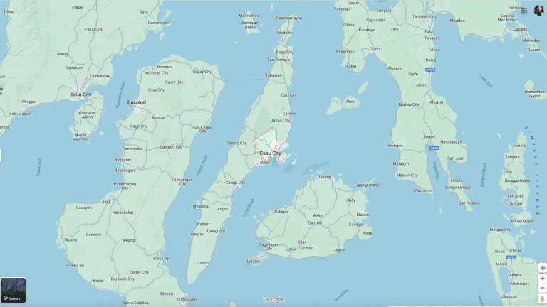
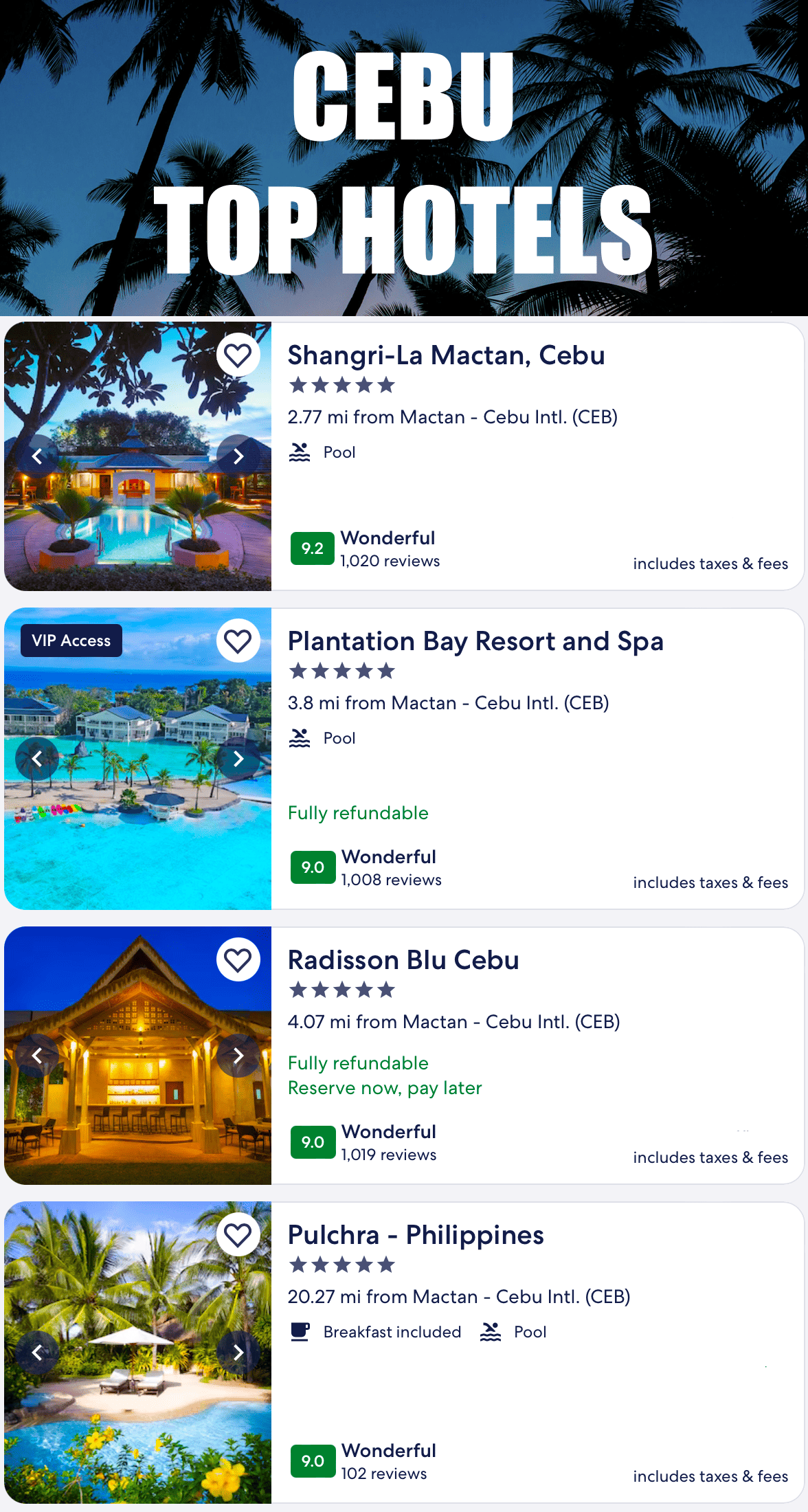
Maps of Cebu offer a detailed representation of this Philippine region, encompassing everything from the urban grid of Cebu City to the natural landscapes of beaches and mountains. Useful for navigation, planning, and exploration, these maps blend practicality with insights into Cebu’s rich history and culture. With digital platforms like Google Maps, they provide real-time information, making them essential for both locals and tourists.
Table of Contents
Cebu Maps
Top 10 Questions and Answers about Maps of Cebu
1. What is a Cebu map?
- A Cebu map is a graphical representation of the Cebu region in the Philippines. It can range from simple road maps to detailed geographical maps showing topography, urban layouts, and points of interest.
2. Where can I find a map of Cebu?
- Maps of Cebu can be found online through various mapping services like Google Maps. Physical maps can be purchased at local bookstores, tourist centers, or specialty map stores in the region.
3. What types of maps are available for Cebu?
- Available types include street maps, tourist maps, topographical maps, and digital interactive maps. Each serves different purposes, from navigation to exploring tourist attractions or studying the geography.
4. Can I access a detailed street map of Cebu City online?
- Yes, detailed street maps of Cebu City are accessible online through services like Google Maps, which provide comprehensive and up-to-date information on city streets.
5. Are there historical maps of Cebu available for viewing?
- Historical maps of Cebu can often be found in local libraries, museums, or online archives. These maps provide insights into the historical development and changes in the region.
6. How can I use a Cebu map for travel planning?
- A Cebu map can be used to plan travel routes, identify accommodations, locate tourist attractions, and understand the layout of the region for a more efficient and enjoyable travel experience.
7. Are there interactive road maps of cities located in Cebu that show current traffic and road conditions?
- Yes, interactive maps like Google Maps offer real-time traffic updates in Cebu, allowing users to plan their routes based on current road conditions.
8. Can I find a map of Cebu that highlights its natural features?
- Yes, topographical and environmental maps of Cebu highlight natural features such as mountains, rivers, beaches, and forests. These can be useful for outdoor activities and environmental studies.
9. Are there maps of the island with most visited provinces province and cities? the island province with most visited provinces province and cities? best places in the province of Cebu that focus on numerous tourist spots province, cities and tourist attractions?
- Tourist maps of Cebu are specifically designed to highlight popular tourist spots, cultural landmarks, and leisure destinations. These can be found at tourist centers, hotels, or online.
10. How often are online maps of Cebu updated?
- Online maps, especially those provided by major services like Google Maps, are updated regularly. The frequency of updates depends on the provider and changes in the region’s infrastructure and geography.
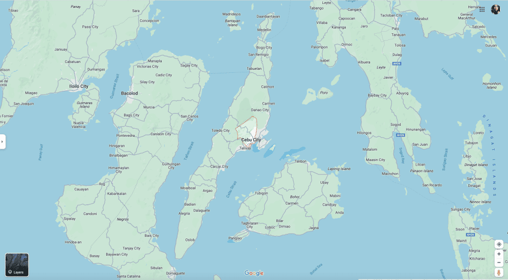
Maps of Cebu Facts
1: Discovering Cebu Through Its Maps
Cebu, an island province nestled in the heart of the Philippines, is a destination where history, culture, and natural beauty converge. Understanding Cebu, its intricate layout, and its rich heritage requires a deep dive into the Cebu map and the map of Cebu, which reveal much more than just geographical information. This article embarks on an exploration of Cebu, utilizing various maps to uncover the many layers that make up this vibrant region.
1.1 The Essence of Cebu in Maps
A Cebu map is more than a tool for navigation; it’s a narrative in itself, telling stories of the past and present. The map of Cebu unfolds the island’s geography – its rolling hills, bustling cities, tranquil beaches, and all the roads that connect these diverse landscapes. Every line, symbol, and color on these maps holds a piece of Cebu’s story, waiting to be explored and understood.
1.2 Cebu City: The Urban Heart
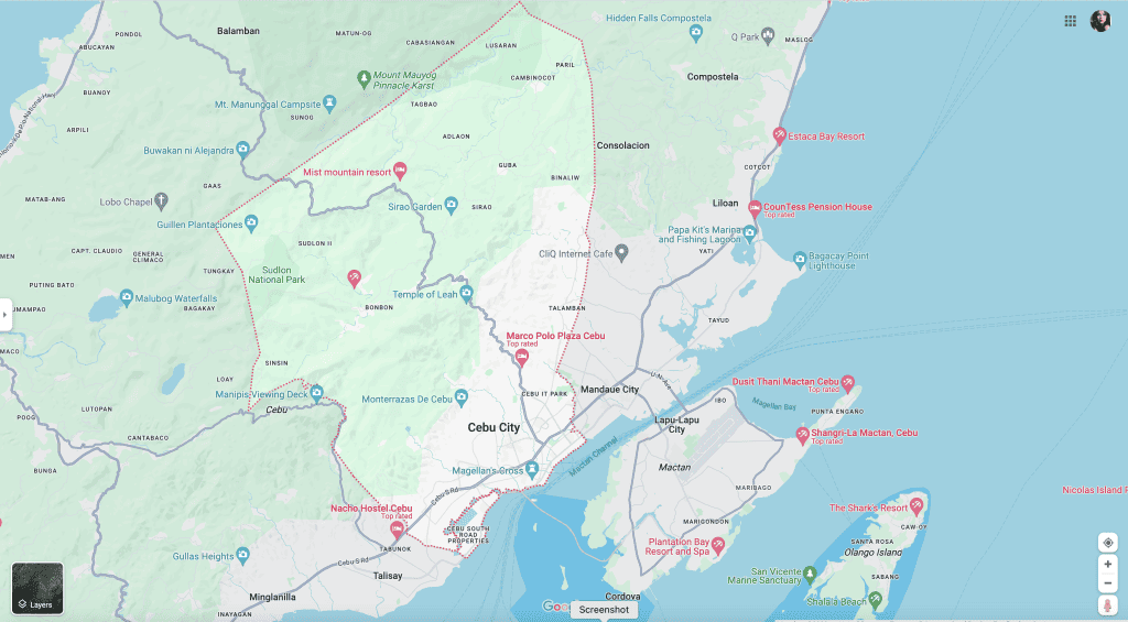
At the core of the satellite image of the Cebu map project page and image lies Cebu City, the province’s capital. The map page and image of Cebu City is a testament to its history as the oldest city in the Philippines, showcasing a blend of colonial architecture and modern urban development. Through the streets and alleys marked on the image and the borders of districts on each page and image of the map page and image, one can trace the city’s evolution from a pre-colonial trading port to a bustling modern metropolis.
1.3 Exploring Beyond the City
Moving beyond the borders of the city limits, the Cebu province road map reveals a broader and more diverse landscape. The road map of Cebu province encompasses everything from the metropolitan area to the rural, untouched corners of the island. This part of the Cebu province the road map offers a glimpse into the province’s varied topography – from the northern mountainous regions to the southern coastal towns.
1.4 The Role of Google Map in Navigating Cebu
In today’s digital age, Google Map has become an invaluable asset in navigating the intricate landscapes of Cebu. Google Map Cebu provides real-time data, street views, and a comprehensive overview of the entire province, making it easier for both locals and tourists to explore the region. Whether it’s a search of finding a hidden beach in the south or a search for a historic church in the heart of the city, Google Map Cebu is an essential guide.
1.5 The Cultural and Historical Journey through Maps
Each map of Cebu is a canvas that captures a part of the province’s rich cultural and historical journey. From ancient trade routes to sites of historical significance, the maps of Cebu City and the larger Cebu province map are dotted with landmarks that tell the tale of the region’s past – a past marked by colonial encounters, local heroism, and a blend of diverse cultural influences.
1.6 The Natural Beauty of Cebu
The Cebu map is also a testament to the island nation’s natural beauty. From the mountain ranges in the north, shown on the map of Cebu island, to the country with famous white-sand beaches and diving spots in the south east asia below, the natural landscapes of the island of Cebu are diverse and breathtaking. The maps of the island of Cebu not only guide adventurers to these natural wonders but also highlight the importance of preserving these pristine environments.
The maps of Cebu – whether the detailed Cebu City map, the expansive Cebu province map, or the user-friendly Google Map Cebu – collectively paint a vivid picture of this Philippine jewel. They serve as gateways to the heart of Cebu, inviting exploration, understanding, and appreciation of this dynamic region’s geography, history, and culture.
2: The Layers of History and Culture in Cebu’s Maps
Continuing our exploration of map of cebu philippines, map of cebu philippines, map of cebu philippines, map of cebu philippines, map of cebu philippines and map of Cebu philippines through its maps, we delve deeper into the historical and cultural significance embedded within the map of Cebu philippines, map of cebu philippines, and the first map of Cebu philippines. These maps are more than mere geographical tools; they are rich tapestries of history, culture, and natural splendor, each offering a unique perspective into the heart of map of Cebu philippines.
2.1 Tracing Cebu’s Historical Journey
The map of Cebu is a testament to the region’s storied past. Historical landmarks, ancient trade routes, and remnants of colonial heritage are all etched into the Cebu map, narrating a saga of conquests, resistance, and cultural fusion. From the Spanish-era churches marked on the Cebu City map to the ancient battlefields noted on the broader map of Cebu, each point on the page of these maps is a gateway to a fascinating historical tale.
2.2 Cultural Richness Reflected in Maps
The Cebu map also reflects the cultural richness of the region. Festivals, traditional crafts, and culinary hotspots are all part of the cultural landscape depicted in the map of Cebu. The Cebu City map, in particular, highlights areas where cultural vibrancy is most palpable – from heritage sites to modern-day cultural centers, offering a glimpse into the living traditions and evolving arts of the region.
2.3 Navigating the Natural Landscapes
The natural beauty of Cebu island is prominently featured in the map of Cebu. The cebu island’s diverse ecosystems, from mountainous areas to marine sanctuaries, are all part of the same Cebu island and province map. These maps not only guide nature enthusiasts to breathtaking locations but also emphasize the importance of preserving these natural wonders.
2.4 The Role of Google Map in Cultural Exploration
Google Map Cebu has revolutionized how we explore and interact with the region. Offering detailed street views and comprehensive information, Google Map Cebu has become an essential tool for those looking to delve into the cultural and historical depths of Cebu. It facilitates an immersive exploration experience, bridging the gap between past and present.
2.5 The Living Traditions and Modernity
The Cebu map is a blend of the old and the new, showcasing how traditional practices and modern lifestyles coexist. The map of Cebu City, for example, depicts areas where one can witness age-old traditions being practiced alongside the hustle and bustle of modern city life. This juxtaposition is a hallmark of Cebu’s unique charm.
2.6 The Broader Perspective: Cebu in the Philippine Context
The map of the Cebu metropolitan area also offers insights into the island’s role in the broader context of the Philippines. As a significant historical and cultural center, the Cebu island and province map highlights its strategic importance in the archipelago – both as a hub of regional activity and as a key player in the nation’s narrative.
The exploration of Cebu through its maps – the detailed Cebu City map and the expansive map of Cebu island and province – reveals a region rich in history, culture, and natural beauty. The Cebu map is more than just a navigational aid; it’s a storyteller, inviting us to delve deeper into the soul of this vibrant region.
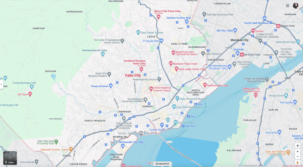
3: Exploring the Geographical Diversity of Cebu Through Its Maps
This section of our article delves into the geographical diversity of Cebu as depicted through the Cebu map and the map of Cebu. These maps not only serve as guides to the physical landscape but also as windows into the environmental richness of the region.
3.1 Unveiling the Geographical Marvels
The Cebu map is a vivid portrayal of the cebu island’s diverse geography. From the rugged mountains in the northern parts, south east asia and southeast asia shown on the map of northern Cebu island and below, to the serene white-sand beaches in the south east asia above and southeast south east asia below, the Cebu island and province map is a testament to the cebu island’s varied natural landscapes. These geographical features are not just attractions but also pivotal in understanding the Cebu island’s environmental and cultural identity.
3.2 Navigating Cebu City’s Urban Geography
The Cebu City map page and image provides an insightful look into the urban geography of the province’s capital. Here, Google Map Cebu’ page and image becomes an essential tool, offering detailed street views and insights into the city’s layout. The map and image of Cebu City reflects its urban planning, its road infrastructure, and the juxtaposition of historic sites located amidst modern developments.
3.3 Exploring the Rural and Natural Landscapes
Beyond the urban landscapes, the map of Cebu province reveals a more rural and natural setting. The Cebu province south map, or South Cebu map, is particularly noteworthy for showcasing areas with lush vegetation, agricultural lands, and unspoiled natural beauty. These areas highlighted in the Cebu map play a crucial role in the ecological balance and rural economy of the region.
3.4 The Significance of Google Map in Environmental Exploration
Google Map Cebu is more than just a navigation tool; it’s a means to explore and appreciate Cebu’s environmental diversity. With features like satellite imagery and street views, Google Map Cebu allows for a closer look at the island’s varied ecosystems, helping in planning sustainable tourism and conservation efforts.
3.5 Cebu’s Geography in the Context of Climate and Conservation
The Cebu map also brings to light the island’s geographical significance in the context of climate change and environmental conservation. The diverse landscapes, as seen in the map of Cebu, are not only natural treasures but also areas requiring careful environmental stewardship and sustainable practices.
The exploration of Cebu through its maps, particularly the Cebu City map and the broader map of Cebu province, offers a comprehensive understanding of the region’s geographical diversity. These maps are instrumental in guiding us through the province’s urban, rural, and natural landscapes, each contributing uniquely to the tapestry of Cebu.
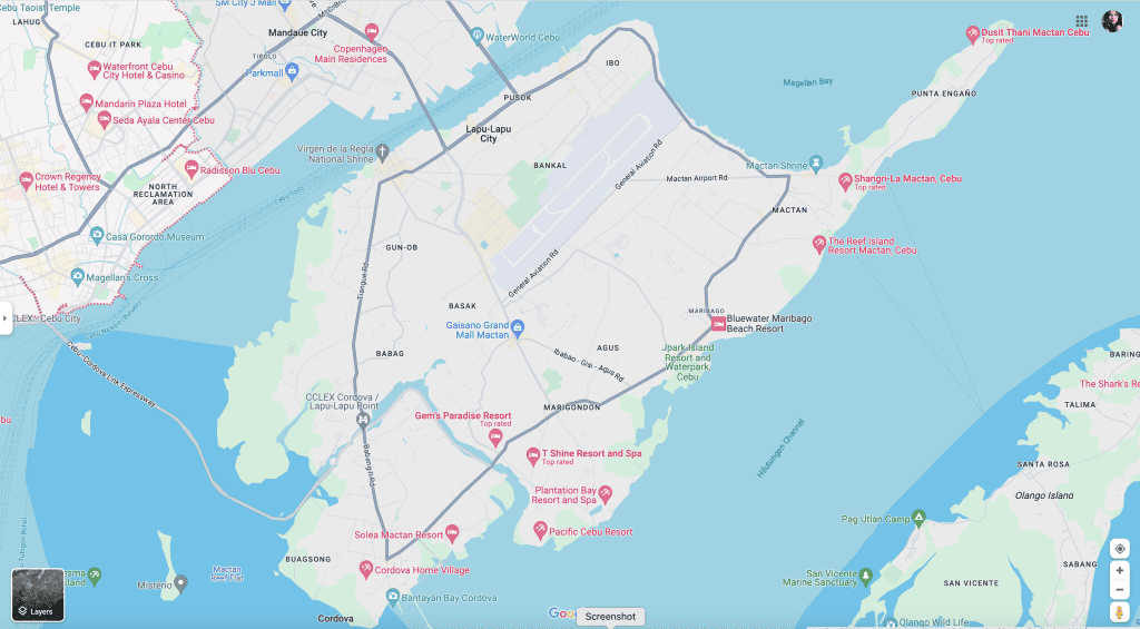
4: The Socio-Economic Landscape of Cebu as Depicted in Its Maps
This section of our exploration into Cebu’s maps focuses on the socio-economic aspects as represented in the Cebu map and the map of Cebu. These maps not only delineate geographical boundaries but also provide insights into the economic activities, population distribution, and social dynamics of the region.
4.1 The Economic Hubs Highlighted in the Cebu Map
The map image of Cebu is a reflection of the province and nation’s economic landscape. Major economic hubs, industrial parks, resorts, and business districts are clearly marked on the Cebu province map image. These areas, particularly highlighted in blue on the Cebu City map image, show the concentration of economic activities and their role in the overall development of the region and nation.
4.2 Population Centers and Urbanization Trends
The Cebu City map and the broader map of Cebu province also shed light on population centers and urbanization trends. The density of roads, residential areas, and commercial establishments on Google Map of Cebu cities reveals patterns of urban growth and migration, which are pivotal in understanding the demographic shifts and urban planning challenges in the Cebu cities.
4.3 Rural Cebu: Agricultural Landscapes and Communities
Moving away from the urban centers, the satellite image of the map of Cebu province unveils the rural landscapes spice islands that form the backbone of the island’s agricultural sector. The Cebu south map, in particular, highlights regions where agriculture and fishing are predominant, showcasing the island and rural economy’s contribution to the overall socio-economic fabric of Cebu province.
4.4 Google Map Cebu: A Tool for Economic Insight
Google Map Cebu serves as a vital tool in analyzing and understanding the socio-economic and political landscape of the region. It provides detailed views of infrastructure development, transportation networks, and commercial zones, allowing for a comprehensive analysis of economic activities and their geographic distribution across Cebu.
4.5 Socio-Economic Challenges and Opportunities
The Cebu map and the map of Cebu province not only illustrate the current socio-economic landscape but also highlight the challenges and opportunities present. Issues such as urban congestion, environmental sustainability, and regional disparities become apparent when studying the maps, guiding policymakers and stakeholders in addressing these challenges.
The Cebu map, in all its forms, is an invaluable resource in understanding the socio-economic landscape of the region. From the bustling streets of Cebu City to the rural tranquility of the southern parts of the island, the maps of Cebu provide a comprehensive overview of the region’s economic activities, demographic patterns, and social dynamics.
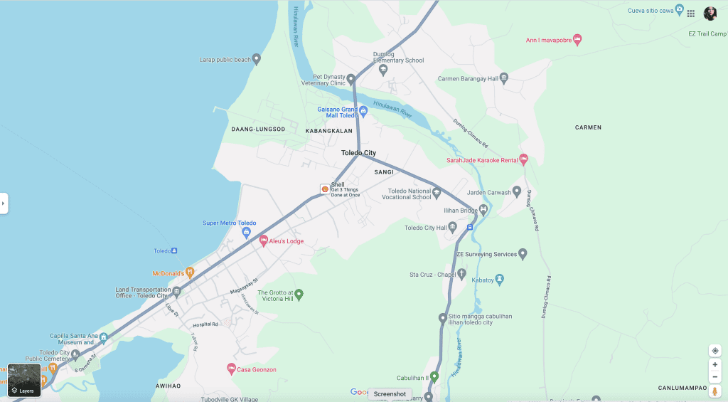
5: The Intersection of Tradition and Modernity in Cebu’s Maps
This section delves into how the Cebu map project and the world map of Cebu capture the unique blend of tradition and modernity that defines the region. These maps are not just geographic representations; they are storytellers that chronicle the evolution of Cebu from its historical roots to its contemporary developments.
5.1 Traditional Roots in the Cebu Map
The map of Cebu is imbued with the island nation and province’s rich traditions. Historical landmarks, ancient religious sites, and traditional markets, prominent in the Cebu City map, offer a glimpse into the country with enduring cultural practices and heritage that have been passed down through generations. These elements on the Cebu map are vital in understanding the cultural identity of the region.
5.2 Modern Developments and Urban Growth
Conversely, the map of Cebu also illustrates the modern developments and urban growth that Cebu has experienced, especially evident in the Cebu City map. Google Map Cebu provides an up-to-date view of the new infrastructures, commercial centers, and residential developments, showcasing the rapid urbanization and modernization of the region.
5.3 Blending the Old and New
One of the most striking aspects of the Cebu map is how seamlessly traditional and modern elements coexist. The map above a satellite image of Cebu City, for example, shows ancient churches and historical buildings standing alongside contemporary skyscrapers and business complexes. This blend is a testament to Cebu’s ability to embrace modernity while preserving its rich heritage.
5.4 Rural Cebu: Maintaining Traditions
In the rural areas, as depicted in the broader map of Cebu province, traditional ways of life continue to flourish. The Cebu south map, particularly, highlights areas where age-old agricultural practices and fishing traditions remain integral to the local communities’ lifestyle and economy.
5.5 The Role of Google Map in Bridging Eras
Google Map Cebu plays a crucial role in bridging the old and the new. It helps in navigating not only the physical space of Cebu but also in understanding the socio-cultural evolution of the region. Through Google Map Cebu, one can explore the historical sites and modern tourist attractions that together weave the fabric of Cebu’s identity.
The maps of Cebu – from the detailed streets in the Cebu City map to the expansive landscapes in the Cebu province map – are narratives of a region that has skillfully blended tradition with modernity. These maps tell the story of Cebu’s evolution and serve as a guide to understanding the complex yet harmonious nature of this vibrant region.
6: Navigating Cebu’s Future Through Its Maps
This section of our article explores how the Cebu map and the map of Cebu not only reflect the region’s past and present but also provide insights into its future. These maps, evolving with time, offer a glimpse into the developmental trajectory, environmental sustainability, and future planning of Cebu.
6.1 Mapping Development and Progress
The map of Cebu is a dynamic entity, continually updated to reflect the region’s growth and development. New infrastructural projects, expanding urban areas, and evolving landscapes are all chronicled in the Cebu map, particularly noticeable in the Cebu City map. These changes on the map signify the ongoing progress and modernization efforts within the region.
6.2 Urban Planning and Its Challenges
As the Cebu City map becomes denser with urban development, it also highlights the challenges of urban planning. Google Map Cebu serves as a tool for city planners and policymakers to visualize urban sprawl, traffic congestion, and the allocation of green spaces, aiding in the creation of sustainable urban development plans.
6.3 Environmental Concerns and Conservation Efforts
The map of Cebu province also brings environmental concerns to the forefront. The Cebu south map, for example, shows areas of ecological significance, such as forest reserves and marine sanctuaries. These maps play a crucial role in environmental conservation efforts, helping to identify areas that require protection and sustainable practices.
6.4 The Role of Technology in Mapping the Future
Advancements in mapping technology, as seen in Google Map Cebu, are instrumental in planning for Cebu’s future. They offer detailed and up-to-date data that can be used for various purposes, from disaster risk management to the development of smart cities, ensuring that growth is balanced with sustainability.
6.5 Envisioning the Future Through Maps
The Cebu map project is more than a depiction of the island at present; it is also a canvas for envisioning the island and future. By analyzing current population trends and patterns visible in the map of Cebu, stakeholders can strategize for future developments, ensuring that growth is inclusive, sustainable, and beneficial for all Cebuanos.
As we navigate through the various layers of the Cebu map and the map of Cebu, it becomes clear that these tools are invaluable in understanding not only where Cebu has been but also where it is headed. They offer a roadmap for the future, guiding the region towards sustainable growth and development while preserving its rich heritage and natural beauty.
7: The Evolving Role of Maps in Cebu’s Tourism and Culture
This section explores how the Cebu map and the map of Cebu play a crucial role in the region’s tourism and cultural preservation. These maps not only guide tourists but also serve as tools for cultural education and heritage conservation.
7.1 The Cebu Map as a Tourist Guide
The Cebu map is an indispensable tool for tourists. It guides them through the province from the maze of streets in Cebu City, to the tranquil beaches and towns in the south, and to the mountainous regions in the north. Each part of the province on the map of Cebu offers a different adventure, a different experience, showcasing the diversity of the region’s attractions.
7.2 Cultural Insights Through the Map of Cebu
The map of Cebu is also a gateway to the region’s rich cultural heritage. Historical landmarks, traditional markets, and cultural centers are prominently featured on the Cebu City map. These sites offer tourists and locals alike a deeper understanding of Cebu’s history and traditions, fostering a sense of combination of pride and preservation.
7.3 Google Map Cebu: Enhancing Visitor Experience
Google Map Cebu enhances the visitor experience by providing detailed and interactive views of attractions and cities. Whether it’s finding the best route to a secluded beach or a virtual tour of a historical site, Google Map Cebu adds an extra layer of convenience and engagement for tourists exploring cities in the region.
7.4 Mapping Cebu’s Festivals and Events
Cebu is known for its vibrant festivals and cultural events. The Cebu map highlights these events, allowing visitors to plan their trips around these celebrations. The map of Cebu City, in particular, becomes a vibrant representation of these festivities, inviting tourists to partake in the region’s lively cultural scene.
7.5 The Role of Maps in Cultural Preservation
Beyond navigation, the Cebu map plays a vital role in cultural preservation. By highlighting historical sites and cultural landmarks, these maps raise awareness about the importance of preserving Cebu’s heritage. They serve as educational tools, helping to instill a sense of responsibility towards heritage conservation among locals and visitors alike.
The Cebu map and the map of Cebu are more than just geographical representations; they are vital tools in promoting tourism and preserving the rich cultural heritage of the region. They guide, educate, and inspire, playing a significant role in the cultural and economic vitality of Cebu.
8: The Integration of Cebu’s Maps with Modern Technology
This section delves into how modern technology has revolutionized the way we interact with the map of Cebu island, map and the map of Cebu. These technological advancements have not only made navigation easier but also enhanced our understanding and appreciation of the region.
8.1 Advancements in Digital Mapping
The evolution of digital mapping has transformed the traditional Cebu map into a dynamic, interactive tool. Google Map Cebu is a prime example of this, offering real-time data, satellite imagery, and detailed street views of cities. This digital version of the map of Cebu allows users to explore cities and regions in the region with unprecedented ease and accuracy.
8.2 Enhancing Tourist Experiences
For tourists, the advancements in the Cebu map technology mean a more enriched travel experience. Interactive maps provide insights into tourist spots, routes, and attractions, making the map of Cebu an essential travel companion. This technology also helps in planning itineraries, locating accommodations, and discovering hidden gems across the region.
8.3 The Role of Maps in Urban Planning
The Cebu City map, enhanced by modern mapping technology, is a critical tool in urban planning and development. Planners and authorities utilize these advanced maps to visualize urban growth, plan infrastructure, and manage environmental impacts on cities. The map of Cebu City, therefore, becomes a blueprint for sustainable development.
8.4 Maps in Environmental Management
Modern mapping technologies have also been instrumental in environmental management across Cebu. The map of Cebu province, equipped with data on terrain, land use, and natural resources, aids in conservation efforts, disaster management, and ecological studies. These maps help in identifying vulnerable areas and in strategizing protective measures.
8.5 Educational and Cultural Implications
The integration of technology with the Cebu map has educational and cultural implications. Interactive maps serve as educational tools, providing valuable insights into the region’s geography, history, and culture. They help in preserving and promoting Cebu’s rich heritage, making it accessible to a broader audience.
The integration of modern technology with the Cebu map and the map of Cebu represents a significant advancement in how we interact with and understand this region. These technological enhancements have not only simplified navigation but also broadened the scope of maps as tools for education, planning, and conservation.
9: The Impact of Maps on Cebu’s Socio-Cultural Dynamics
This section explores how the Cebu map and regions on the map of Cebu influence and reflect the socio-cultural and political dynamics of the region. These maps are more than geographical and political representations; they are mirrors of society, showcasing the interplay of cultural, political, social, political, and economic factors in Cebu.
9.1 Maps Reflecting Cebu’s Social Fabric
The Cebu map is a reflection of the region’s diverse social fabric. It highlights areas of different ethnic and cultural significance, showing how these communities contribute to the rich tapestry of Cebu. The map of Cebu City, for instance, delineates neighborhoods that have become cultural melting pots, each with its unique character and heritage.
9.2 Economic Disparities and Development
The map of Cebu also sheds light on economic disparities within the region. Areas of affluence and underdevelopment are both visible, providing insights into the economic challenges and opportunities in Cebu. The Cebu City map particularly shows the contrast between rapidly developing urban areas and regions that still retain a more traditional economic structure.
9.3 Cebu’s Evolving Cultural Landscape
Cultural evolution in Cebu is evident in its maps. Traditional cultural sites, modern entertainment districts, and educational institutions are all marked on the map of Cebu, illustrating the region’s cultural shift and adaptation to modern influences while still preserving its heritage.
9.4 The Role of Maps in Community Engagement
The Cebu map plays a crucial role in community engagement and development. It helps in identifying areas where community initiatives and programs can be directed for maximum impact. The map of Cebu serves as a tool for local governments and organizations to plan and implement community-driven projects effectively.
9.5 Tourism and Cultural Preservation
The map of Cebu is instrumental in promoting tourism and cultural preservation. It guides tourists to cultural landmarks, heritage sites, and local festivals, helping to boost tourism while fostering an appreciation for the region’s heritage. The Cebu City map, in particular, highlights key and numerous tourist spots and tourist attractions, that are central to the region’s cultural identity.
The Cebu map and the map of Cebu are integral in understanding and navigating the socio-cultural landscape of the region. They provide valuable insights into the social, economic, and cultural dynamics of Cebu, playing a vital role in everything from urban planning and community development to tourism and cultural preservation.
10: Cebu’s Maps as a Gateway to its Environmental Consciousness
This section delves into how the Cebu map and the map of Cebu are not just tools for navigation but also windows into the region’s environmental consciousness and sustainability efforts. These maps highlight the natural wonders of Cebu, the challenges faced by the environment, and the steps taken towards sustainability.
10.1 Highlighting Natural Wonders on the Cebu Map
The map of the island province of Cebu is replete with natural wonders, from pristine beaches to lush forests. The Cebu south map image below, for instance, leads to some of the most beautiful and ecologically significant areas in the cebu island and region. These natural highlights located on various regions and districts of the Cebu map emphasize the island nation’s rich biodiversity and the importance of preserving its natural heritage.
10.2 Mapping Environmental Challenges
The map of Cebu also reflects the environmental challenges facing the region. Areas of deforestation, urban sprawl, and pollution hotspots can be identified, providing insights into the environmental pressures exerted by development and population growth. The Cebu City map, in particular, illustrates the challenges of urban environmental management.
10.3 Sustainable Development and the Cebu Map
Sustainability efforts in Cebu are evident on its maps. Areas designated for conservation, renewable energy projects, and eco-tourism sites are marked, showing the region’s commitment to sustainable development. The map of Cebu province becomes a tool for identifying and promoting sustainable practices.
10.4 The Role of Google Map in Environmental Awareness
Google Map Cebu contributes to environmental awareness by providing detailed imagery and information about the region island’s topography, land use, and natural resources. It allows users to visualize the impact of human activities on the country and environment and can be a powerful tool in environmental education and advocacy.
10.5 Promoting Eco-Tourism through Maps
The Cebu map project is instrumental in promoting eco-tourism. By highlighting eco-friendly destinations and providing routes to less-traveled natural areas, the map of Cebu encourages responsible tourism that appreciates and preserves the natural environment.
The Cebu map project and the map of Cebu are much more than geographical guides; they are reflections of the region’s relationship with its environment. They showcase the beauty and vulnerability of Cebu’s natural environment, the challenges of sustainability, and the efforts towards environmental preservation and sustainable tourism.
11: The Integration of Cebu’s Historical and Modern Landscapes in Its Maps
This section explores how the Cebu map and the map of Cebu seamlessly integrate the region’s historical and modern landscapes, offering a comprehensive view that spans centuries of change and development.
11.1 Capturing Cebu’s Historical Essence
The map of Cebu is rich with historical significance. Ancient landmarks, historical routes, and heritage sites are prominently featured, especially in the Cebu City map. These elements not only provide a glimpse into the past but also serve as vital links to understanding Cebu’s historical journey and cultural evolution.
11.2 Reflecting Urban and Modern Development
Contrasting its historical features, the Cebu map also vividly illustrates the region’s urban and modern development. The map of Cebu City, in particular, displays a vibrant urban layout, showcasing the city’s growth as a commercial and technological hub. This blend of old and new is a defining characteristic of the Cebu map, representing the region’s dynamic progression.
11.3 Balancing Tradition and Modernity
One of the remarkable aspects of the Cebu map is its representation of the balance between tradition and modernity. Historical sites coexist with modern infrastructures, reflecting a society that values its heritage while embracing contemporary advancements. This balance is particularly evident in the map of Cebu City, where centuries-old structures stand alongside modern skyscrapers.
11.4 The Role of Maps in Cultural Preservation
The Cebu map plays a crucial role in cultural preservation. By highlighting historical sites and cultural landmarks, these maps raise awareness about the importance of preserving Cebu’s rich cultural heritage. They serve as a reminder of the region’s history and as an educational tool for new generations.
11.5 Maps as a Tool for Sustainable Urban Planning
The integration of historical and modern elements in the Cebu map is also significant for sustainable urban planning. The map of Cebu City, with its detailed representation of urban spaces, serves as a guide and model for city planners in designing spaces and cities that respect historical sites while accommodating modern needs.
The Cebu map and the map of Cebu offer a unique perspective that interweaves the historical with the modern. These maps are not just tools for navigation but also a testament to the region’s ability to preserve its past while forging a path towards a progressive future. They reflect the coexistence of tradition and modernity, a characteristic that is central to the identity of Cebu.
12: The Evolution of Cartography in Cebu and Its Implications
This section examines how the practice of cartography in Cebu has evolved over time, transforming the Cebu map and the map of Cebu into more than just navigational tools. These maps now serve as vital resources for understanding the region’s development, environmental changes, and cultural shifts.
12.1 From Ancient Charts to Modern Maps
The journey of mapmaking in Cebu has been a remarkable one. Early maps of Cebu were rudimentary, focusing mainly on coastal outlines and significant landmarks. Over time, these evolved into more detailed depictions, as seen in the modern Cebu map and the map of Cebu, which offer comprehensive views of topography, infrastructure, and urban development.
12.2 The Role of Technology in Modern Cartography
Technological advancements have significantly altered the landscape of cartography in Cebu. The introduction of satellite imagery, GIS (Geographic Information Systems), and digital mapping tools has enhanced the accuracy and utility of the Cebu map. Google Map Cebu, for example, utilizes these technologies to provide real-time data and interactive features.
12.3 Maps and Urban Development
The map of Cebu City, with its detailed urban layout, highlights the region’s rapid urbanization. These maps are crucial in urban planning and development, allowing for efficient land use, infrastructure development, and traffic management. They reflect the growing needs of the population in a modernizing city and province, while also identifying areas requiring preservation and conservation.
12.4 Environmental Monitoring and Mapping
The map of Cebu province has become an essential tool in environmental monitoring. It helps in identifying areas affected by environmental degradation, such as deforestation, urban sprawl, and pollution. These maps play a critical role in conservation efforts and in formulating strategies for sustainable development.
12.5 Cultural Heritage and Tourism
Maps of Cebu have also become significant in promoting cultural heritage and tourism. They guide tourists to historical sites, cultural landmarks, and natural attractions, contributing to the region’s tourism industry. The Cebu map thus serves as a bridge between Cebu’s rich past and its present-day allure as a tourist destination.
Conclusion
The evolution of cartography in Cebu, from simple charts to sophisticated digital maps, mirrors the region’s own journey through history. Today, the Cebu map and the map of Cebu are indispensable tools, serving a multitude of purposes from urban planning and environmental management to cultural preservation and tourism. They are reflections of Cebu’s dynamic nature, capturing its essence in lines, colors, and symbols.
