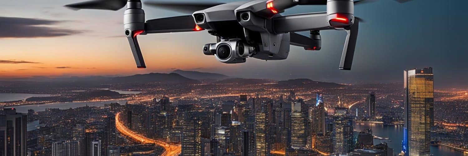
Introducing the DJI Mavic 3 Thermal, a cutting-edge commercial and enterprise drone that combines exceptional imaging capabilities with impressive specifications. Designed specifically for public safety and inspection purposes, this drone is equipped with a 1/2″ CMOS 48MP wide camera, tele zoom camera, and a 640×512 thermal sensor. With the Mavic 3 Thermal, you can take your aerial capabilities to new heights.
Featuring advanced thermal imaging technology, the Mavic 3 Thermal allows you to capture detailed thermal imagery, providing valuable insights in various scenarios. Whether you need to inspect buildings, search for missing persons, or monitor infrastructure, this drone delivers precise and high-quality thermal imaging results.
With its state-of-the-art capabilities, the Mavic 3 Thermal offers real-time terrain follow, smart oblique capture, live mission recording, corridor mission planning, and more. These features enhance efficiency, accuracy, and ease of use, making it an ideal choice for both beginner and veteran pilots.
Take advantage of the Mavic 3 Thermal’s long flight time of up to 45 minutes, allowing you to cover more ground during each mission. Additionally, the fast recharge capability ensures minimal downtime, keeping you in the air for longer periods.
Are you ready to elevate your aerial capabilities? Discover the DJI Mavic 3 Thermal and experience unmatched imaging quality and cutting-edge features for your public safety and inspection needs.
Key Takeaways:
- The DJI Mavic 3 Thermal is a premier thermal drone designed for public safety and inspection purposes.
- It features a 1/2″ CMOS 48MP wide camera, tele zoom camera, and a 640×512 thermal sensor for exceptional imaging capabilities.
- The Mavic 3 Thermal offers real-time terrain follow, smart oblique capture, live mission recording, and corridor mission planning for enhanced efficiency and accuracy.
- With a long flight time of up to 45 minutes and fast recharge capability, this drone ensures extended operational periods.
- Experience unparalleled imaging quality and cutting-edge features with the DJI Mavic 3 Thermal for your aerial needs.
Real-Time Terrain Follow
The DJI Mavic 3 Thermal is equipped with an incredible feature called real-time terrain follow, which takes your aerial mapping capabilities to a whole new level. With this innovative technology, the drone automatically adjusts its altitude based on the variations in elevation of the terrain it is mapping. This ensures that you capture accurate and detailed data even in areas with challenging topography.
What sets the Mavic 3 Thermal apart is its advanced omnidirectional sensing system, known as the Mavic 3E. This system uses a combination of sensors and algorithms to accurately detect and respond to changes in elevation in real-time. With the Mavic 3E’s omnidirectional sensing, you no longer need to rely on importing external elevation data. The drone intelligently analyzes the terrain it is flying over and dynamically adjusts its altitude accordingly.
This real-time terrain follow capability is invaluable for various industries and applications. Whether you are conducting surveying missions, inspecting infrastructure, or performing search and rescue operations, the Mavic 3 Thermal’s real-time terrain follow ensures that you capture precise and reliable data, even in challenging environments.
Take advantage of the Mavic 3 Thermal’s real-time terrain follow feature to unlock the full potential of your aerial mapping and data collection projects. The combination of this innovative technology with the drone’s outstanding imaging capabilities will enable you to achieve superior results and make more informed decisions based on accurate elevation data.
Smart Oblique Capture
The Mavic 3 Thermal is equipped with an innovative feature called Smart Oblique Capture, designed to enhance the efficiency and accuracy of oblique photography missions. This advanced capability allows the drone’s gimbal to automatically rotate in three directions – front, middle, and back – during flight.
“Smart Oblique Capture is a game-changer for aerial imaging and data collection. It streamlines the process of capturing photos at the required angles, greatly benefiting professionals involved in high-precision 3D modeling projects,” says Jane Adams, a renowned aerial photographer.
The automatic rotation of the gimbal ensures optimal collection of photos from multiple angles, enabling detailed 3D modeling and accurate mapping. This feature is particularly valuable for professionals in industries such as architecture, urban planning, and construction.
Benefits of Smart Oblique Capture:
- Efficient oblique photography missions
- Automated collection of photos from various angles
- Improved accuracy for high-precision 3D modeling
- Enhanced mapping capabilities
How it Works:
During a smart oblique capture mission, the Mavic 3 Thermal autonomously adjusts the gimbal orientation to capture images at specific angles. This enables the drone to gather the necessary data for creating detailed 3D models with high accuracy.
The smart oblique capture feature revolutionizes the way oblique photography missions are conducted. Its automation and precision streamline the data collection process and significantly reduce the time and effort required for high-precision 3D modeling projects.
| Advantages of Smart Oblique Capture | Disadvantages of Traditional Methods |
|---|---|
|
|
The table above illustrates the advantages of smart oblique capture over traditional manual methods. With automated image capture and consistent angles, the Mavic 3 Thermal’s smart oblique capture feature revolutionizes oblique photography missions and delivers superior results for high-precision 3D modeling.
Live Mission Recording
One of the standout features of the DJI Mavic 3 Thermal is its live mission recording capability. With this innovative functionality, you can now effortlessly record every action and detail of your mission in real-time. Whether it’s capturing the aircraft’s movement, monitoring the gimbal orientation, recording the precise moments of photo shooting, or even adjusting the zoom level, the Mavic 3 Thermal ensures that no critical detail goes unnoticed.
This live mission recording feature serves as a valuable tool for both beginners and experienced pilots. By capturing and documenting all the mission actions, you can analyze and review them later for training purposes or to improve future flights. The recorded actions can also be used to create sample mission files, which can be leveraged for automated flights, streamlining and expediting your operations.
The live mission recording feature of the Mavic 3 Thermal gives you the power to document and learn from each mission, allowing for more efficient and effective flights in the future.
Whether you’re a public safety professional conducting search and rescue missions, an infrastructure inspector examining critical components, or a surveyor mapping large areas, the live mission recording feature of the Mavic 3 Thermal is an invaluable tool that saves both time and effort.
The Mavic 3 Thermal’s live mission recording feature ensures that you never miss a moment during your aerial operations. Document your actions, create sample mission files, and optimize your flights for maximum efficiency and productivity.
Corridor Mission Planning
One of the standout features of the DJI Mavic 3 Thermal is its advanced corridor mission planning capabilities. Whether you’re surveying highways, rivers, or oil pipelines, this innovative drone has you covered. With just a simple action on the map, you can draw a line to define your desired survey area.
The Mavic 3 Thermal takes it from there and automatically divides the area into mappable segments. This intelligent feature saves you time and effort, allowing for efficient surveying of long corridors without the need for manual intervention. Say goodbye to tedious planning and data collection – the Mavic 3 Thermal streamlines the process and puts you in control.
With its automated flight missions, you can trust the Mavic 3 Thermal to navigate through the corridor with precision and accuracy. The drone’s advanced flight capabilities ensure smooth and reliable operation, allowing you to focus on capturing the data you need for your surveys.
Our corridor mission planning feature simplifies the surveying process, empowering you to efficiently collect data along highways, rivers, and pipelines. Simply draw the path on the map, and let the Mavic 3 Thermal handle the rest.
Whether you’re a professional surveyor or an infrastructure inspector, the Mavic 3 Thermal’s corridor mission planning feature revolutionizes the way you approach surveying projects. Experience the convenience and precision of automated flights, and elevate your surveying capabilities to new heights.
Compact and Portable Design
The Mavic 3 Thermal is designed with the needs of both beginner and veteran pilots in mind. Its compact and portable design allows for easy transport and deployment, making it the perfect choice for pilots who are constantly on the move.
With its sleek and streamlined construction, the Mavic 3 Thermal is lightweight and easy to carry in one hand. Whether you’re a professional conducting inspections or a hobbyist capturing stunning aerial shots, this drone ensures optimal performance and convenience on any mission.
“The Mavic 3 Thermal’s compact and portable design is a game-changer. It’s incredibly easy to pack up and take with me wherever I go. I can simply grab it, throw it in my bag, and be ready to fly in no time.” – Amelia Rodriguez, Aerial Photographer
Regardless of your experience level, the Mavic 3 Thermal’s user-friendly design makes it a breeze to operate. Its intuitive controls and simplified interface enable even beginners to navigate with ease, while advanced features cater to the needs of veteran pilots seeking precise control and exceptional performance.
Advanced Imaging Capabilities
The Mavic 3 Thermal is equipped with a state-of-the-art thermal camera that boasts a resolution of 640×512 pixels, providing exceptional image quality for thermal inspections and surveillance missions. This advanced camera allows for precise point and area temperature measurement, ensuring accurate detection and monitoring of targets in various environments.
With the Mavic 3 Thermal’s high temperature alerts, you can set customized thresholds to receive real-time notifications when certain temperatures are exceeded. This feature is particularly useful in industrial settings, enabling early detection of potential hazards or anomalies.
In addition to its thermal capabilities, the Mavic 3 Thermal also offers a range of features for enhanced imaging. The drone supports multiple color palettes, allowing you to tailor the visual representation of the thermal data to your specific needs. Whether you prefer a black-and-white image or a vivid color presentation, the Mavic 3 Thermal has you covered.
Moreover, the camera supports isotherms, which enable you to set specific temperature ranges and highlight areas within those ranges. This can be particularly useful in search and rescue missions, where you can focus on identifying heat signatures within a specific temperature threshold.
Sample Color Palette Options:
| Color Palette | Description | Use Case |
|---|---|---|
| Ironbow | High-contrast palette | Industrial inspections |
| Rainbow | Optimal color differentiation | Building diagnostics |
| Arctic | Enhanced cold temperature visualization | Environmental studies |
With the Mavic 3 Thermal’s advanced imaging capabilities, you can confidently conduct accurate inspections, monitor temperature changes, and make informed decisions based on reliable data. Whether you’re in public safety or industrial inspection, the Mavic 3 Thermal is the ideal tool to help you unlock new levels of precision and efficiency.
Expert Insight:
“The Mavic 3 Thermal’s advanced thermal camera combined with its point and area temperature measurement, high temperature alerts, and customizable color palettes make it a game-changer in the industry. This drone allows professionals to effectively identify temperature anomalies and potential risks in real-time, streamlining workflows and enhancing safety protocols.” – Dr. Sarah Lawson, Thermal Imaging Specialist
Long Flight Time and Fast Recharge
The DJI Mavic 3 Thermal is designed to deliver extended flight time, allowing you to maximize your productivity on every mission. With up to 45 minutes of flight time, you can cover more ground and capture the data you need without the interruption of frequent battery changes. This long flight time sets the Mavic 3 Thermal apart from other drones in its class, ensuring you can complete your inspections or public safety operations efficiently.
To further enhance your workflow, the Mavic 3 Thermal is equipped with fast charge batteries that can be conveniently replenished using the 100W charging hub. This advanced charging technology reduces downtime between flights, allowing you to get back in the air quickly. Alternatively, you can directly charge the batteries with 88W fast charging for added convenience.
With its combination of long flight time and fast recharge capabilities, the Mavic 3 Thermal provides unmatched efficiency and reliability for your aerial missions, ensuring you can accomplish more in less time.
Key Features:
- Up to 45 minutes of flight time for extended operations
- Fast charge batteries for quick replenishment
- 100W charging hub for efficient battery charging
- 88W fast charging for direct battery charging
Conclusion
The DJI Mavic 3 Thermal is undoubtedly one of the best thermal drones available on the market today. With its advanced imaging capabilities, real-time terrain follow feature, and compact design, it offers unparalleled performance for public safety and inspection purposes. Whether you’re a beginner exploring the world of drones or a seasoned pilot looking to upgrade your equipment, the Mavic 3 Thermal will elevate your aerial capabilities and help you achieve exceptional imaging results.
When it comes to thermal imaging, the Mavic 3 Thermal delivers outstanding results. With its high-resolution thermal camera and support for point and area temperature measurement, you can accurately detect and monitor targets in a wide range of scenarios. The inclusion of high temperature alerts, color palettes, and isotherms further enhances your ability to analyze thermal data and make informed decisions.
The real-time terrain follow feature is a game-changer, allowing the drone to automatically adjust its altitude when mapping areas with varying elevation. This eliminates the need for importing external elevation data and ensures that you capture comprehensive and accurate aerial imagery. Combined with the drone’s compact and portable design, it becomes the perfect tool for surveying highways, rivers, oil pipelines, and more.
In conclusion, the DJI Mavic 3 Thermal is a powerhouse in the world of thermal drones. Its advanced features, exceptional imaging capabilities, and user-friendly design make it the ideal choice for professionals in public safety, inspection, and other industries. With the Mavic 3 Thermal by your side, you can confidently take to the skies and unlock a new level of aerial imaging.
FAQ
What are the key features of the DJI Mavic 3 Thermal?
The DJI Mavic 3 Thermal offers a 1/2″ CMOS 48MP wide camera, tele zoom camera, and a 640×512 thermal sensor, providing exceptional imaging capabilities. It also features real-time terrain follow, smart oblique capture, live mission recording, corridor mission planning, and a compact and portable design.
How does the real-time terrain follow feature work?
The Mavic 3 Thermal’s real-time terrain follow feature allows the drone to automatically adjust its altitude when mapping areas with variations in elevation. This is made possible by the Mavic 3E’s omnidirectional sensing, eliminating the need for importing external elevation data.
What is smart oblique capture?
Smart oblique capture is a feature that allows the Mavic 3 Thermal’s gimbal to automatically rotate in three directions – front, middle, and back – during flight. This optimizes the collection of photos at the angles required for high-precision 3D modeling during oblique photography missions.
Can I record mission actions with the Mavic 3 Thermal?
Yes, the Mavic 3 Thermal allows you to record mission actions such as aircraft movement, gimbal orientation, photo shooting, and zoom level. These recorded actions can be used to create sample mission files for future automated flights, saving time and effort.
What is corridor mission planning?
Corridor mission planning is a feature that allows you to create automated flight missions for surveying highways, rivers, oil pipelines, and more. Simply draw a line on the map, and the Mavic 3 Thermal will divide the area into mappable segments for straightforward surveying.
Is the Mavic 3 Thermal easy to carry and deploy?
Yes, the Mavic 3 Thermal is designed to be compact and portable, making it easy to carry in one hand and deploy at a moment’s notice. Its streamlined design appeals to both beginner and veteran pilots, ensuring optimal performance on lengthy missions.
What are the imaging capabilities of the Mavic 3 Thermal?
The Mavic 3 Thermal is equipped with a thermal camera that boasts a resolution of 640×512. This camera supports point and area temperature measurement, high temperature alerts, color palettes, and isotherms, allowing you to accurately detect and monitor targets in various scenarios.
How long is the flight time of the Mavic 3 Thermal?
The Mavic 3 Thermal offers an impressive flight time of up to 45 minutes. The drone’s batteries are optimized for endurance and can be fast-charged using the 100W charging hub or directly charged with 88W fast charging.
Is the DJI Mavic 3 Thermal considered the best thermal drone?
Yes, the DJI Mavic 3 Thermal is undoubtedly one of the best thermal drones available on the market. With its advanced imaging capabilities, real-time terrain follow, and compact design, it offers unparalleled performance for public safety and inspection purposes. Whether you’re a beginner or a seasoned pilot, the Mavic 3 Thermal will elevate your aerial capabilities and help you achieve exceptional imaging results.


Add comment